
Negro-Branco Moist Forests
The ecoregion’s land area is provided in units of 1,000 hectares. The protection goal is the Global Safety Net (GSN1) area for the given ecoregion. The protection level indicates the percentage of the GSN goal that is currently protected on a scale of 0-10. N/A means data is not available at this time.
Bioregion: Northern Amazonian Forests (NT20)
Realm: Southern America
Ecoregion Size (1000 ha):
20,228
Ecoregion ID:
484
Protection Goal:
94%
Protection Level:
3
States: Colombia, Venezuela, Brazil
The Negro-Branco Moist Forests ecoregion consists of forested lowland plains, with some wide, rolling hill-lands, and low sandstone table mountains. In the understory of this forest, the endemic black-headed uakari monkeys can be found searching for their favorite seasonal fruits. Here they live in groups of more than 35 and will move together along known routes through the treetops to follow fruiting patterns, knowledge that are passed along through generations.
Uakari can jump up to 6 m and are well adapted to moving quickly through trees. The “canopy highways” they follow are often used by other species as well and link the upper canopy ecosystems. Unfortunately, these treetop highways are very susceptible to breakage as vegetation are cleared for roads and paths construction by humans.
.jpg)
The flagship species of the Negro-Branco Moist Forests ecoregion is the black-headed uakari. Image credit: Jean337, Creative Commons
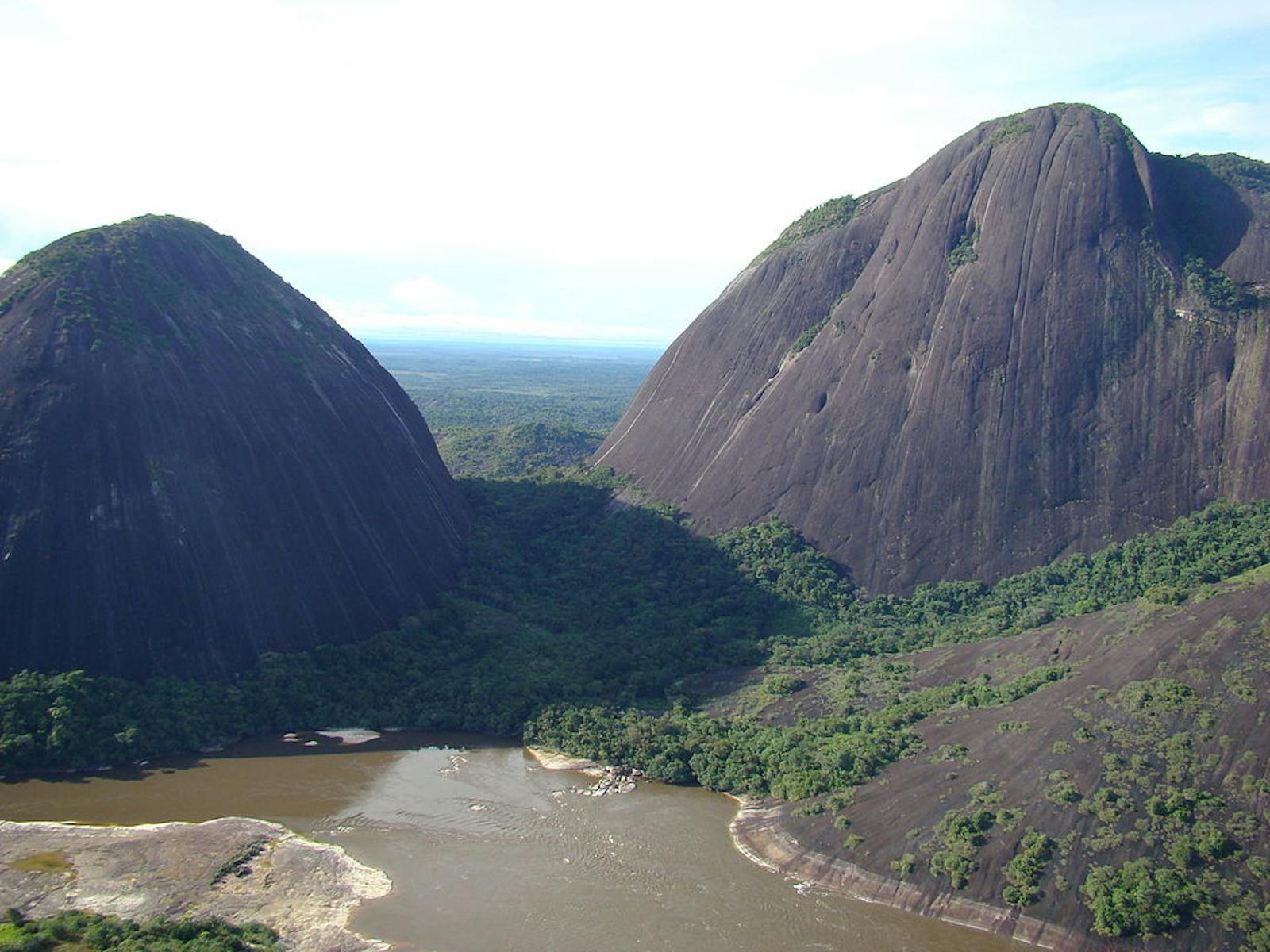
Rivers in the countries of Colombia, Venezuela, and Brazil bind the Negro-Blanco Moist Forests ecoregion. To the north in Colombia the border is formed by the Rio Vichada and in Venezuela by the Rio Ventuari. The southern border in Colombia follows the Guainía River to its headwaters, the middle Guaviare River, to the Guainia-Negro River along the Venezuela-Colombia border, and finally continues along the Rio Negro into Brazil east to the Rio Branco. The elevation ranges from 120 m in the western section to upwards of 400 m in Venezuela.
A complex mixture of soil types that are generally poor in nutrients characterizes this ecoregion. The vegetation consists of both flooded and non-flooded lowland moist forests, tall to medium-tall evergreen lowland forests, isolated shrub communities, and herbaceous savanna-like meadows. This ecoregion hosts a high level of plant diversity with considerable endemism. The forests are biologically distinct from the classical Amazon forest. In the Rio Negro Basin part of the ecoregion to the west of the confluence of the Rio Negro and Rio Branco hosts a large area of igapó forest, which is seasonally flooded for five to six months each year by blackwater rivers.
The canopy reaches 35 m with some of the most abundant tree species being sweetgum and broadleaf cattail. The economically important piassaba palm is endemic to this ecoregion. This diverse ecoregion is considered an area of high botanical endemism, including the genera of carnations, Chinese fringe flower, Magnolia spp., and Agarwood.
Among the over 190 mammal species found here, few are completely restricted to this ecoregion. The species that are endemic include the black headed uakari monkeys, bearded sakis, opossums, bats, and several rodents. The bird species richness is approximately 486 species. A number of birds occur only here or are shared with a few neighboring ecoregions. These include the endemic gray-legged tinamous, crestless curassows, double-striped thick-knees, oilbirds, tawny-tufted toucanets, the endemic Orinoco piculets, two endemic antbirds, spot-tailed nightjars, azure-naped jays, and white-naped seedeaters.
Reptiles and amphibians are abundant. The more well-known snakes that occur here include fer-de-lance, palm pit-vipers, coral snakes, boa constrictors, and bushmasters. Iguanas are ubiquitous and tegus lizards common.
-Found%20in%20484-CC-Dominic%20Sherony-2009.jpg)
Oilbird (Steatornis_caripensis). Image credit: Dominic Sherony, Creative Commons
Due to the inaccessibility of this ecoregion, the forest remains largely intact. Only unpaved roads exist to the north and west of the ecoregion in Colombia. People living along the rivers practice small-scale rotational subsistence agriculture, and boat traffic along the rivers brings loggers and merchants. Brazil nut collectors set fire to the lower portion of the forest as a management practice. This alters the understory in some stands, but this is a localized practice.
The main concern is that leaves of the piassaba palm are harvested to make brooms for international markets, and this species may be overexploited. The largest biosphere reserve in the tropics, the Alto Orinoco-Casiquiare Biosphere Reserve, lies mostly in this ecoregion. In Brazil a small portion of this ecoregion lies within the Pico da Neblina National Park.
Conservation priority for the next decade are to: 1) establish protected areas in the transitional zone between the Amazon lowlands and the Guyana Shield to maintain protection of the intact forests; 2) conduct growth and yield studies on the piassaba palm to develop a sustainable management plan for its extraction; and 3) maintain and regulate the access to and traffic through this remote region to minimize external impact.
Citations
1. Sears, R., C.Marín. 2018. Northern South America: Eastern Colombia into Venezuela and Brazil. https://www.worldwildlife.org/ecoregions/nt0143. 8 August 2018.
2. Daly, D. C., and J. D. Mitchell. 2000. Lowland vegetation of tropical South America. Pages 391-453 in D. L. Lentz, editors, Imperfect balance: Landscape transformations in the Precolumbian Americas. New York: Columbia University Press.
3. Pires, J. M., and G. T. Prance. 1985. The vegetation types of the Brazilian Amazon. Pages 109-145 in G. T. Prance and T. E. Lovejoy, editors, Key Environments: Amazonia. New York: Pergamon.

Subscribe to receive monthly updates on climate solutions, environmental heroes, and the profound beauty and wonder of our shared planet Earth.