%20Kotsopoulos-Flickr-2.jpg?auto=compress%2Cformat&w=1600)
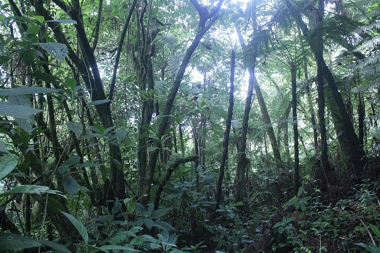


Mount Cameroon and Bioko Montane Forests
The ecoregion’s land area is provided in units of 1,000 hectares. The protection goal is the Global Safety Net (GSN1) area for the given ecoregion. The protection level indicates the percentage of the GSN goal that is currently protected on a scale of 0-10. N/A means data is not available at this time.
Bioregion: Gulf of Guinea Coastal Forests & Mangroves (AT17)
Realm: Afrotropics
Ecoregion Size (1000 ha):
115
Ecoregion ID:
21
Protection Goal:
100%
Protection Level:
6
States: Cameroon, Equatorial Guinea
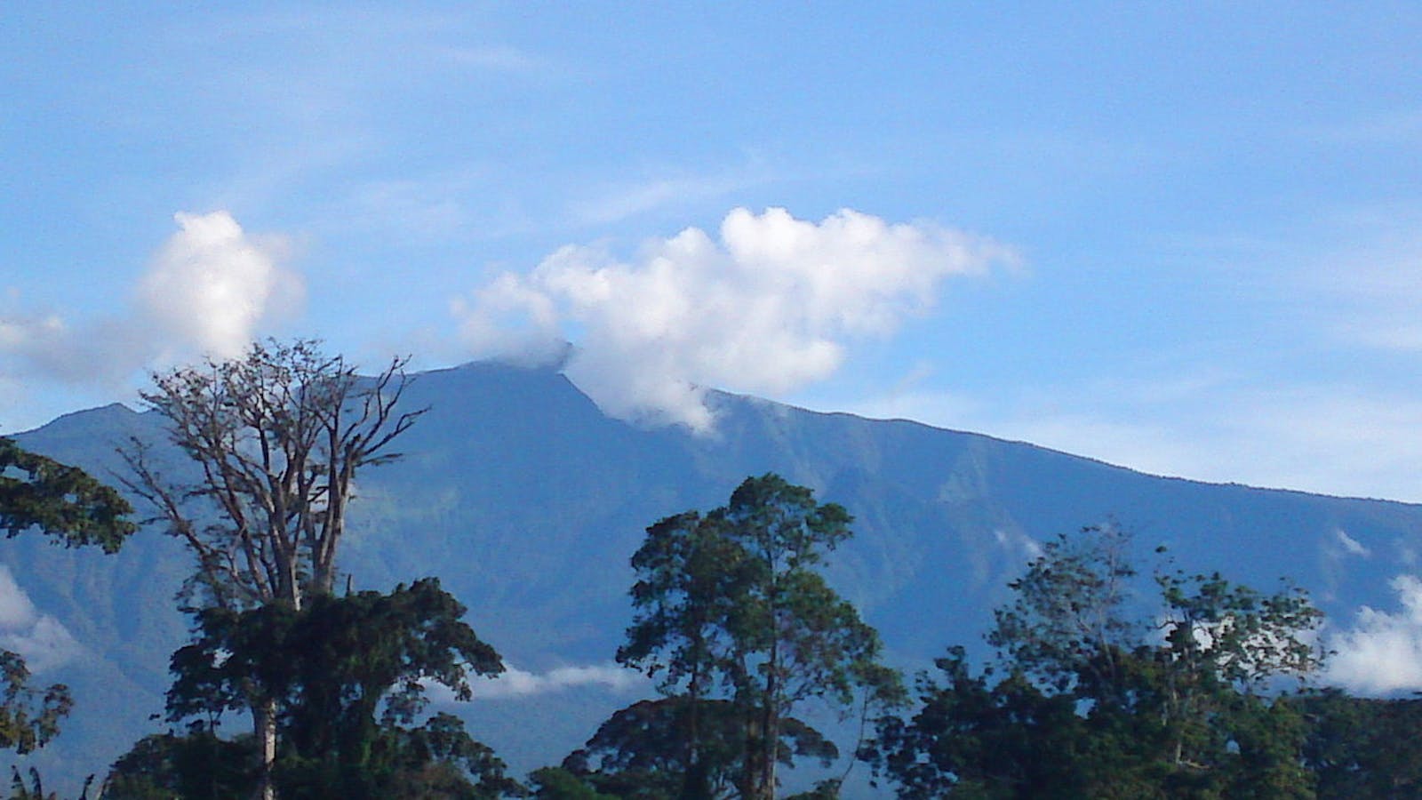
The dramatic history of Mount Cameroon and Bioko’s volcanic eruptions leaves its mark on the ecoregion through barren lava fields, rifting, collapsed scars, and cinder cones. Bioko and Mount Cameroon, the tallest peak in the region at 4,095 m, display a range of habitats from submontane and montane forests to subalpine grasslands. Due to this diversity of habitats within a restricted geographical area, there is high species richness including the strictly endemic Arrogant shrew, an endemic subspecies of drill on Bioko, and the endemic Buea small tongue toad.
The flagship species for the Mount Cameroon and Bioko Montane Forests ecoregion is the Buea small tongue toad.
The ecoregion occupies the higher elevations of Mount Cameroon on the African mainland and Bioko Island just offshore. The southwestern sides of both Mount Cameroon and Bioko have a virtually continuous wet rainy season, with rainfall reaching 10,000 mm per year in the lower tropical altitudes. Rainfall gradually declines at higher altitudes, with less than 2,000 mm falling at the summit of Mount Cameroon. At the base of these mountains, temperatures average 25.5 to 27°C, and can reach 32 to 35°C during the hottest months (March and April). Temperatures decline at approximately 1°C per 150 m of elevation.
A clear shot of the Arum Italicum flower plant growing in the tropical rain reserve forest of Mount Cameroon. Image credit: Atabong Armstrong, Creative Commons
A number of factors, such as elevation, aspect, and climate influence the diversity of vegetation types in the ecoregion. On Mount Cameroon, montane forests extend from 1,675 m to between 2,200 and 2,400 m in elevation. They are characterized by Schefflera abysssinica, Prunus africana, and I Nuxia congesta. Further above, the forests grade into montane scrub and ultimately into montane grasslands, subalpine communities, and rocky habitats, with common grass vegetation such as Pennisetum monostigma, Swertia abyssinica, and Myrica humilis, as well as Andropogon amethystinus, Deschampsia mildbraedii, and Agrostis mannii.
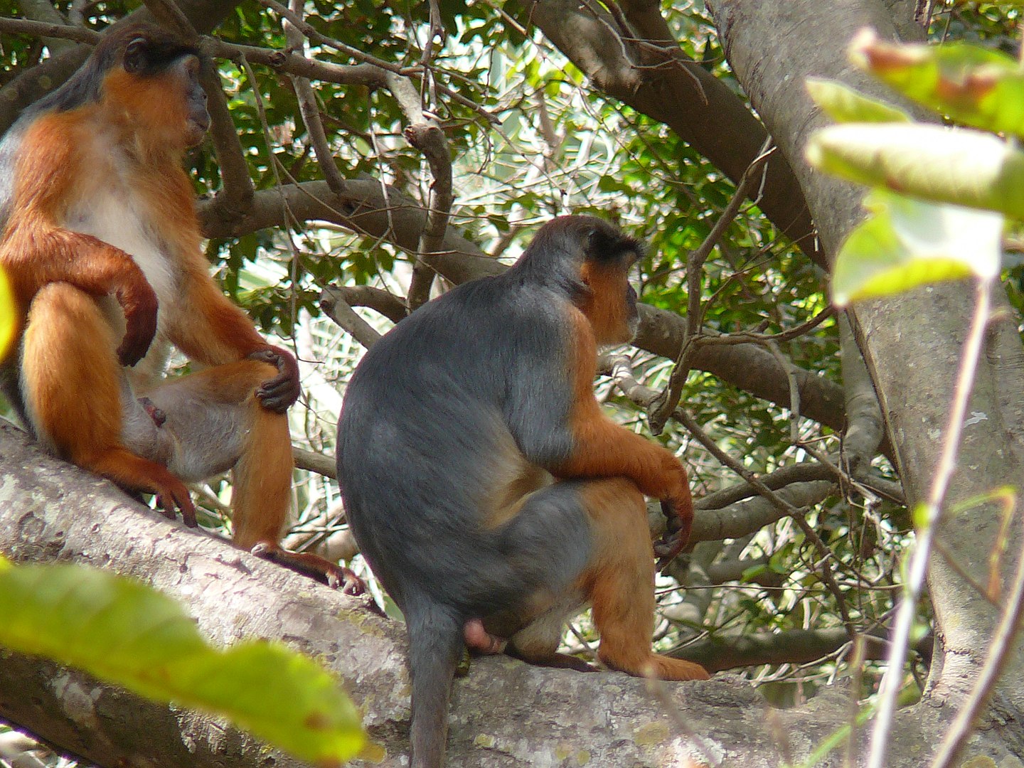
Temminck's red colobus. Image credit: Atamari, Creative Commons
This ecoregion falls within the Afromontane archipelago-like regional centre of endemism and contains exceptional species diversity. At least 42 plant species and three genera are strictly endemic, mostly found at higher elevations, and another 50 species are near-endemic to Mount Cameroon. Many of them belong to the plant families Balsaminaceae, Rubiaceae, Euphorbiaceae, Orchidaceae, and Myrtaceae, and include species from the genera Anigraecopsis, Impatiens, Sacosperma, Salacia, and Trichoscypha.
-CC-Bernard%20Dupont-2005.jpg)
Male drill. Image credit: Image credit: Bernard Dupont, Creative Commons
Twenty-nine of these near-endemic species are also found on the island of Bioko. Over 370 bird species have been recorded, including several endemics. Two species are strictly endemic to Mount Cameroon: Mount Cameroon francolin and Mount Cameroon speirops. Notable species on Bioko include Ursula’s sunbird and the endemic Fernando Po speirops, which is confined to Basilé Peak. Mammals display moderate levels of diversity and endemism.
Mount Cameroon has lost up to half of the forest cover on its eastern side, whereas, on the southern slopes, little habitat has been lost. As the soils of the region are fertile, further conversion of some forest to agriculture is regarded as inevitable. Much of the foothills of Mount Cameroon are the property of the Cameroon Development Corporation (CDC), a parastatal agroindustrial institution.
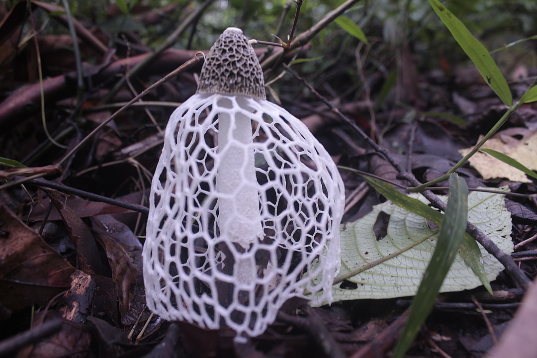
A close shot of the Stinkhorn mushroom growing on the fertile soils of the Mount Cameroon national park. Image credit: Atabong Armstrong, Creative Commons
The majority of Mount Cameroon gained national park status in 2009 (Mont Cameroun, 581.23 km2). Forest reserves restricted for sustained timber uses include Southern Bakundu Forest Reserve and Meme Forest Reserve on Mount Cameroon. Bioko is protected by Basilé National Park (330 km2) and Luba Crater Scientific Reserve (510 km2). Habitat loss on the mountains of Bioko is low, particularly on the southern slopes which are almost completely undisturbed from sea level to summit.
An expanding human population seeking new agricultural land—especially areas that receive less rainfall—and bushmeat is the main source of threat to habitats of the ecoregion. Since the lifting of the ban on red stinkwood (Prunus africana) exploitation in 2010, a management plan in the Mount Cameroon area was implemented and it is now collected again.
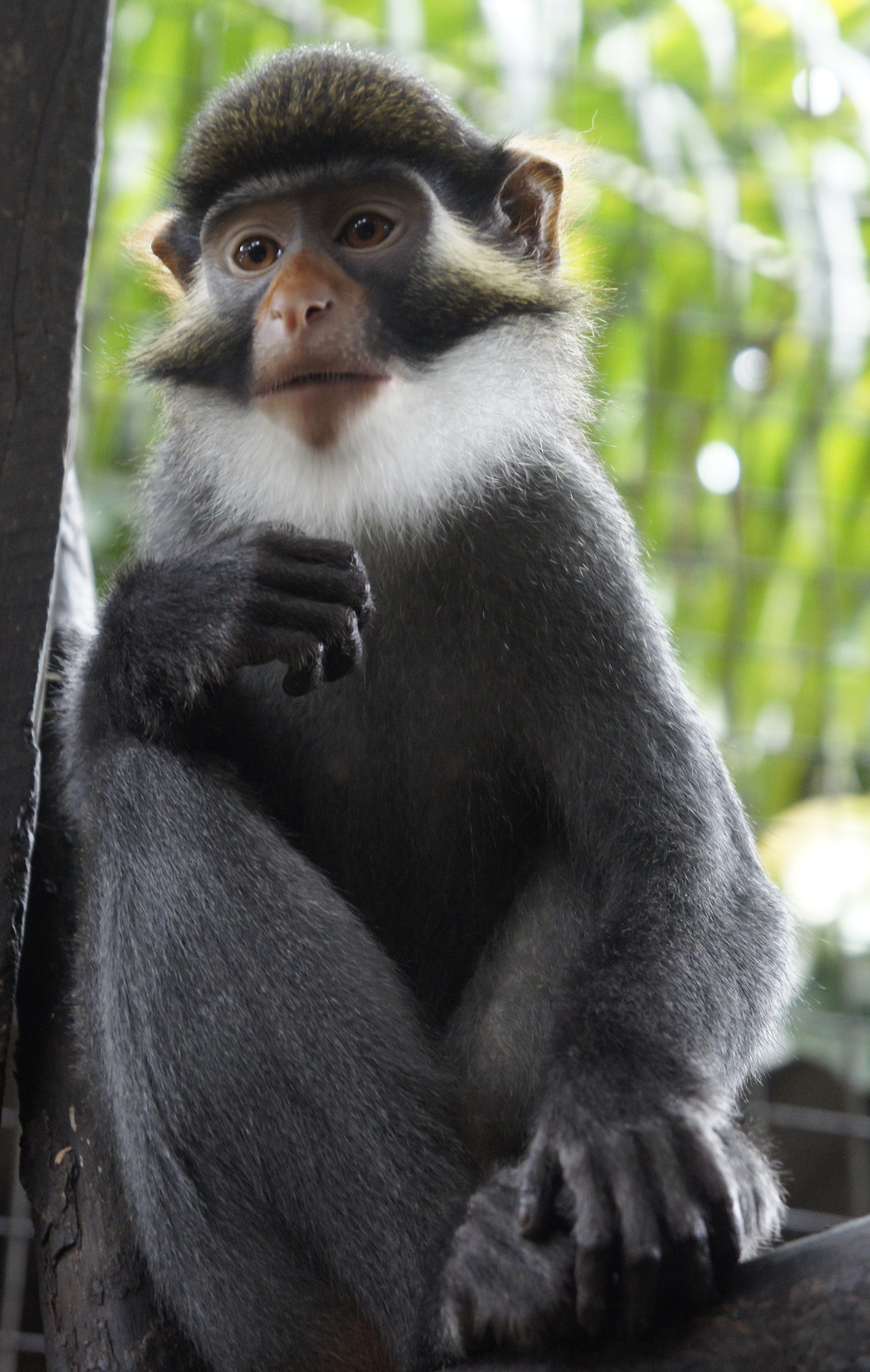
Red eared guenon. Image credit: Creative Commons
Oil palm and rubber plantations, owned by CDC, are found across much of the Mount Cameroon foothills and the establishment of the plantations led to major forest clearances. In some areas, larger mammals have nearly disappeared because of hunting. While hunting pressure is also rising on Bioko, due to the inaccessibility of southern Bioko, the mammal fauna is largely intact. There is also an active trade in live animals to supply the pet trade, including amphibians, reptiles, mammals, and birds.
The priority conservation actions for the next decade will be to: 1) increase the effectiveness of law enforcement, including regular monitoring in protected areas, to prevent poaching; 2) continue implementing the REDD+ initiative to reduce forest loss and increase carbon stock, especially on Mount Cameroon; and 3) support agro-industry to manage high conservation value forested areas.
Citations
1. Critical Ecosystem Partnership Fund. 2015. Ecosystem Profile: Guinean Forests of West Africa Biodiversity Hotspot.
2. The Ministry of Forestry and Wildlife. 2014. The management plan of the Mount Cameroon National Park and its peripheral zone 2015-2019. [Online]. [Accessed 18 January 2018].
3. Cronin, D.T., Woloszynek, S., Morra, W.A., Honarvar, S., Linder, J.M., Gonder, M.K., O’Connor, M.P. and Hearn, G.W. 2015. Long-term urban market dynamics reveal increased bushmeat carcass volume despite economic growth and proactive environmental legislation on Bioko Island, Equatorial Guinea. PLOS One. 10(7).
Subscribe to receive monthly updates on climate solutions, environmental heroes, and the profound beauty and wonder of our shared planet Earth.