

Itigi-Sumbu Thicket
The ecoregion’s land area is provided in units of 1,000 hectares. The protection goal is the Global Safety Net (GSN1) area for the given ecoregion. The protection level indicates the percentage of the GSN goal that is currently protected on a scale of 0-10. N/A means data is not available at this time.
Bioregion: Greater African Subequatorial Savannas & Mixed Woodlands (AT11)
Realm: Afrotropics
Ecoregion Size (1000 ha):
1,107
Ecoregion ID:
46
Protection Goal:
46%
Protection Level:
10
States: Tanzania, Democratic Republic of Congo, Zambia
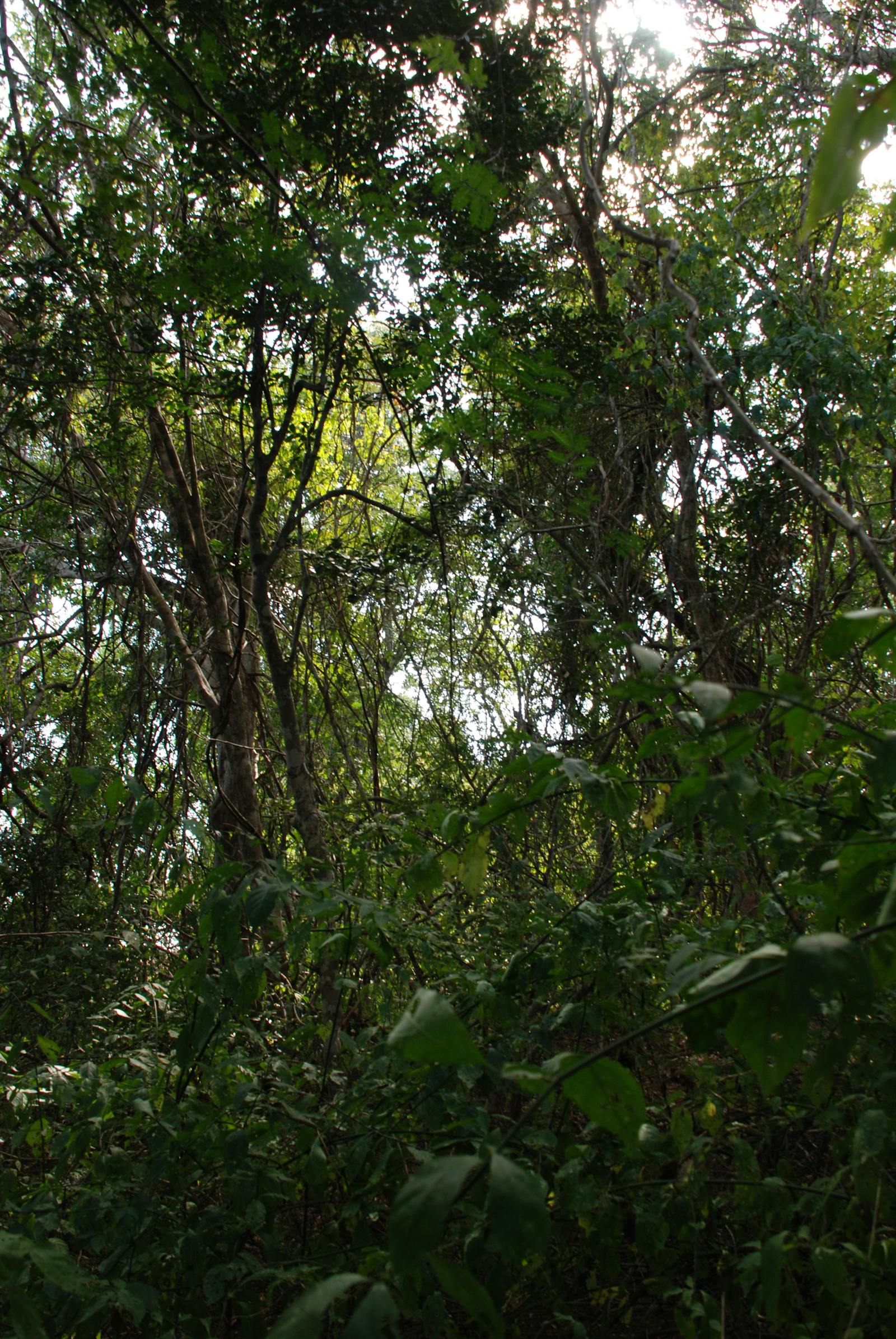
Itigi-Sumbu thicket grows on unique, highly specialized, and sensitive soils that once disturbed, by farming for example, suffer irreversible damage which prevents thicket regeneration. The thicket is a dry, primarily deciduous, impenetrable vegetation between 3 m and 7 m in height. Nearly 100 woody plant species are found here, some of which are endemic. The entire ecoregion is threatened by human encroachment and conversion to slash and burn agriculture. Elephants use the thicket as an important refuge, as did black rhinos before they were eradicated by poachers.
Stands of thicket occur in Tanzania close to its namesake town of Itigi near Dodoma, and also in Zambia between Lakes Mweru Wantipa and Tanganyika. In all cases these thicket units are discrete and clearly demarcated from the surrounding mopane, miombo, or Acacia woodlands.
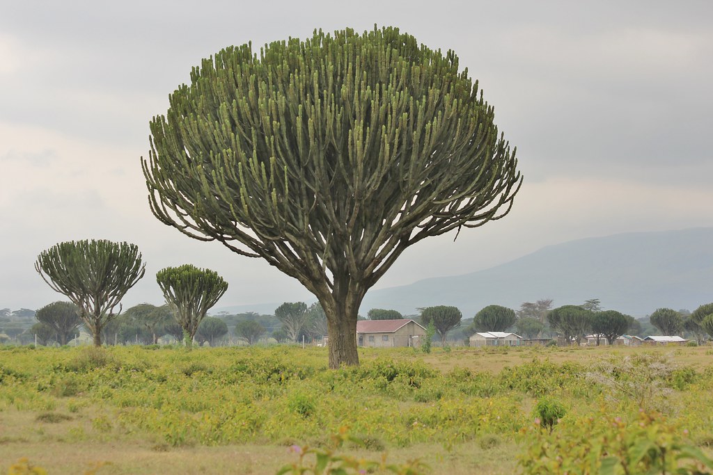
The flagship species of the Itigi-Sumbu Thicket ecoregion is the candelabra tree. Image credit: Courtesy of Mario Ruckh, Flickr.
The rainfall is low; for example, at Manyoni in the Tanzanian Itigi it is around 700 mm per annum. Above the bedrock is a characteristic soil structure, consisting of seasonally well-aerated and well-watered sandy soils of 0.6 m to 3 m in depth that desiccate and harden during the dry season, with an impermeable duricrust of cement-like consistency beneath.
The distribution of the thicket follows that of the duricrust soils. In regions where there is no duricrust, then miombo, mopane, or Acacia savanna woodlands dominate. Itigi thicket vegetation is generally deciduous during the 4 month dry period, although within the lower canopy some of the shrubs are evergreen. During the wetter seasons when leaves are developed, little sunlight penetrates to the ground, and there is a poorly developed herbaceous layer. Woody plant species characteristic of the thicket include Baphia burtti, B. massaiensis, Combretum celastroides, Grewia burttii, Pseudoprosopsis fischeri, and Tapiphyllum floribundum.
The Itigi thicket falls within the Zambezian regional center of endemism. The acidic duricrust soils allow otherwise rare plant species to dominate and outcompete species that are widespread in the surrounding woodlands. A few plants are endemic, although precise numbers are not known.
Compared to the unusual plant composition in this ecoregion, vertebrates are neither distinct, nor abundant. Few large vertebrates can navigate through the dense thicket, although elephants pass with relative ease. The thickets were once important refuges for elephants during the dry season, where they could feed on the seeds of Grewia burttii and Grewia platyclada during the day. Most of the elephants have now been hunted out of the thicket.
The region also supported black rhinoceros before their eradication by poaching. Some sub-specific endemism has evolved in the invertebrates, particularly in the butterfly family Papilionoideae. The ecoregion also support an abundance of termites. Their large termitaria support plants that are otherwise foreign to the community, such as the large Candelabra tree, which is a tall succulent tree with green round-like branches resembling a balloon, and has extremely poisonous milky latex.
The largest blocks of intact Itigi-Sumbu Thicket are found in Zambia on the northern shores of Lake Mweru Wantipa in Mweru Wantipa National Park. Other portions fall within Nsumbu National Park and Kaputa and Tondwa Game management areas. Unfortunately, protected status has not prevented the removal of significant amounts of thicket. The part of the ecoregion occurring in Tanzania is largely unprotected and believed to be heavily degraded. However, small areas fall within the Muhesi Game Reserve, Wembere Game controlled area, and Chaya open area.
The greatest threat to this ecoregion is the increasing human population that drives thicket conversion to slash and burn agriculture. Once cultivated, the duricrust in the soil is destroyed and hence the special soil conditions that are required by Itigi thicket cannot return, even if cultivation stops. Woodland vegetation, and not Itigi thicket regenerates on abandoned farms. Thicket deforestation patterns are correlated with proximity to human settlements.
A large influx of refugees from the Democratic Republic of Congo, between 2002 and 2009 during the political upheaval, settled in the Zambia thickets resulting in an increased level of encroachment. In Zambia, over the past 50 years, 64% of the thicket around Lake Mweru-Wantipa has been removed and in both Tanzania and Zambia the specialized habitats could be removed within the next 50 years. Additionally, mining in this region is a growing threat.
The priority conservation actions for the next decade will be to: 1) further research and monitoring into the deforestation rates of the thickets using both remote sensing and ground truthing methods; 2) promote sustainable agricultural practices; and, 3) promote protected area management to prevent encroachment of important refuge habitats.
Citations
1. Burgess, N., Hales, J.A., Underwood, E., Dinerstein, E., Olson, D., Itoua, I., Schipper, J., Ricketts, T. and Newman, K. 2004. Terrestrial ecoregions of Africa and Madagascar: a conservation assessment. Island Press.
2. Baena, S., Boyd, D.S., Smith, P., Moat, J. and Foody, G.M. 2016. Earth observation archives for plant conservation: 50 years monitoring of Itigi‐Sumbu thicket. Remote Sensing in Ecology and Conservation. 2(2), pp.95-106.
3. Ministry of Lands, Natural Resources and Environmental Protection. 2015. Zambia’s second national biodiversity strategy and action plan (NBSAP -2) 2015-2025. Zambia: Government of the Republic of Zambia.
4. White, F. 1983. The vegetation of Africa, a descriptive memoir to accompany the UNESCO/AETFAT/UNSO Vegetation Map of Africa (3 Plates, Northwestern Africa, Northeastern Africa, and Southern Africa, 1:5,000,000). Paris, France: UNESCO.

Subscribe to receive monthly updates on climate solutions, environmental heroes, and the profound beauty and wonder of our shared planet Earth.