Sudanian Savannas bioregion
The bioregion’s land area is provided in units of 1,000 hectares. The conservation target is the combined Global Safety Net (GSN1) areas for the component ecoregions. The protection level indicates the percentage of the GSN goal that is currently protected on a scale of 0-10. N/A means data is not available at this time.
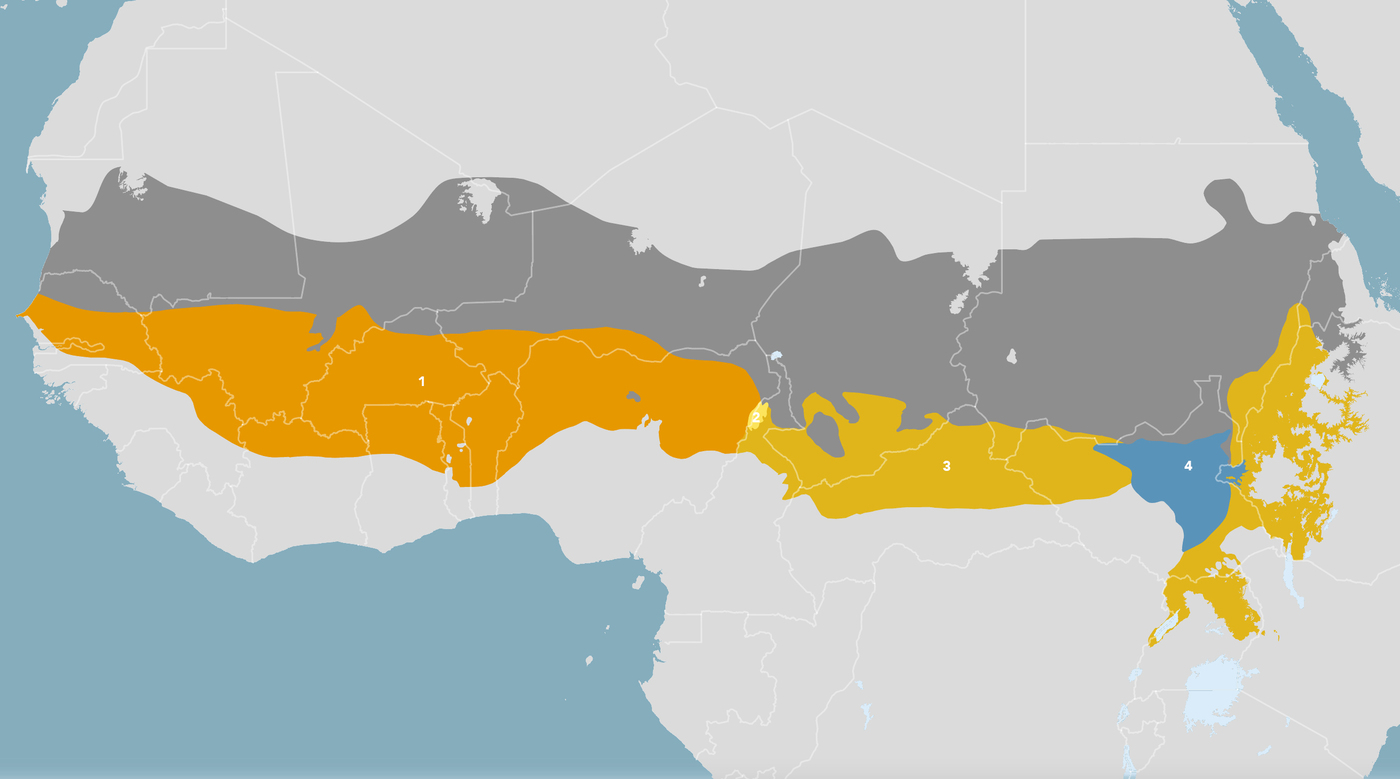
The Sudanian Savannas bioregion, located in the Sub-Saharan Afrotropics subrealm in the Afrotropics, is made up of four ecoregions—East Sudanian Savannas (43), Mandara Plateau woodlands (49), West Sudanian Savanna (62), and the Sudd flooded grasslands (74). These are areas of particular importance for large mammal migrations and includes a network of important national parks along the border between Benin and Burkina Faso.
Fed by the White Nile in Sudan, the Sudd swamps overflow in the raining season, providing nutrients and water to one of the world’s largest floodplains. This makes it particularly important for migrations of birds and large mammals. The land area of this bioregion is approximately 290 million hectares.

The Sudanian Savannas bioregion (AT20) is located in the Sub-Saharan Afrotropics subrealm and is made up of 4 ecoregions: West Sudanian savanna [1], Mandara Plateau woodlands [2], East Sudanian savanna [3], Sudd flooded grasslands [4].
Learn more about the Sudanian Savannas ecoregions below.

Explore the Bioregions
Want to learn more about the fascinating species, diverse ecosystems, and natural wonders of the Earth? Click the button below to launch One Earth's interactive navigator and discover your Bioregion!
LAUNCH NAVIGATOR

